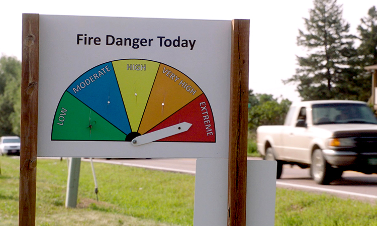
CORE has developed situational awareness tools that provide fire warnings, watches and forecasts for our service territory.
Most of these tools are driven by a geographic information system (GIS) that incorporates wildfire hazard potential maps generated by the U.S. Forest Service’s Fire Modeling Institute overlaid with spatial data representing resources and assets such as power lines, structures and communities. Daily fire risk is also monitored through fire warnings and watches from the National Weather Service, near real-time fire alerts from NASA FIRMS satellites, and social media notifications from fire and police agencies in CORE’s service area.
Our personnel can access this information to adapt CORE’s daily operations, emergency preparedness and risk mitigation efforts to changes in fire conditions. It also allows us to conduct proactive and real-time operations that reduce the risk of fire ignition by our equipment, facilities and activity.
CORE subscribes to DTN Weather Service to receive daily reports of weather conditions in our service territory, including wildfire risk. Additional daily fire risk data is obtained through a combination of map services provided from National Ocean and Atmospheric Association (NOAA)’s Warnings and Watches map service and from the USFS Wildland Fire Assessment System map service. CORE System Operators log weather conditions and send pertinent information and warnings to all Operations personnel and contractors, and GIS republishes these map services to the daily operation map service. This situational awareness allows CORE to adapt daily operations, emergency preparedness, and risk mitigation efforts to changes in fire conditions.

We have developed a system of operating conditions predicated upon each day’s fire risk level:
• Normal allows personnel to operate normally, with no required changes.
• Elevated/Fire Weather Watch cautions crews and contractors to be mindful of elevated fire risk conditions and increase attention paid to situations in which a fire could be ignited.
• Extreme or Red Flag Conditions require that most work on energized overhead lines be halted unless stopping work poses a greater risk. Work that must be completed is done with additional mitigation measures.
Alternate Relay Settings
CORE has implemented more sensitive circuit protection settings, or also known as alternate relay settings, that can be used during High Wind, Red Flag Warnings, or other elevated fire risk conditions. These settings allow the devices protecting the line to trip the instant there is a fault in the line, like if a tree were to fall into the powerlines.
CORE Linemen then patrol the de-energized circuit to find and correct the cause of the outage before re-energizing the line. These settings reduce the risk of fuel ignition near CORE lines and equipment. Since these settings do not allow the equipment to self-restore power, there may be sustained outages instead of blinks while these are in use.
